Thursday, December 6, 2012

Red and Black

Front 3/4 My Kogswell P/R porteur is my go-to bike around town and even takes on occasional short brevet duty. It's got a big porteur rack from Roseland that attaches to the fork crown and mid-fork braze-ons. I also have a custom front boxy porteur bag from Ruth Works Bags. Slowly, the bike's color scheme has moved toward red and black.

A note for my bikeThe frame is black, as well as the saddle, the brakes, the rear derailleur, the downtube shifters, the rack, and the bag. Red parts are less numerous, but certainly stand out--handlebar tape, derailleur pulleys, and now tires, which are Soma B-line tires. I like them in black, but I like them in red even more. They are nice, smooth and quiet tires that are cheaper and last longer than my other favorite Grand Bois red Hetres. I really like how my bike looks and functions right now, apparently, someone else thinks so, too.

Sunday, October 7, 2012

Buddhist Bicycle Pilgrimage 2012 Edition: Day 2

I woke up sunday morning and went to have brunch with the same friends I had dinner with last night. It was a busy weekend at the City of Ten Thousand Buddhas, a Buddhist campus where I work part of the week. A group of Humboldt State University students were making their semiannual visit; a well-respected community member passed away recently and his family was doing a service on campus that day. And of course, the pilgrims on the Buddhist Bicycle Pilgrimage would arrive later on this day. I decided to ride all the way here on day 1 instead of staying with the group at KOA in Asti so I could help to prepare to greet the pilgrims and make sure their program--including a sit-down meal--would go without a hitch.

First two riders to arrive at CTTB on day 2
I got some colleagues to communicate with the kitchen and the assembly hall to confirm the schedule. Scott, who has driven the gear truck for many years of the pilgrimage showed up first. After he unloaded "modesty attires" from the truck we stood on the curb outside the gate for a while. Heidi, whom I have known since the first edition of the pilgrimage, showed up next as she was assigned to help me set up the meals later. It won't be until slightly past 10AM when the first two riders showed up. 10 minutes later, other riders and some volunteer-driven vehicles began to string in. I helped to get them settle down, and gathered them together. Soon, Rev. Heng Sure, who was giving the talk to the group today, came and led a big group of them to the assembly hall for a short tour and a talk. As more pilgrims came in, I directed them toward the assembly hall to join the group.

Dharma Talk inside the Main Hall
I walked in a little later to the hall to check in. I gently inform Rev. Heng Sure that he had 15 minutes left, then I walked with Heidi to the kitchen and began to transport food to the dining hall. The kitchen/restaurant staff had prepare plenty of very delicious vegetarian food for the group, complete with dessert and organic grape juice made from grapes grown in the vineyards on the ground. Soon the group, finished with the talk, came and enjoyed the meal. I waited for most of them to finish eating, then changed into riding gears, and left for Abhayagiri Monastery.


Bikes at the destination
Even though the temperature was noticeably higher than day 1, a light breeze made it fairly comfortable still. I rode through Ukiah toward the northern edge of the town. The day's last "hill" was on Eastside-Calpella Road connecting Ukiah to Redwood Valley. Before I hit the day's last rest stop at Lion's Park, I caught up with Rachel. We rode the last stretch, most of it under the shade of trees lining Tomki Road to Abhayagiri. Surprisingly, we were among the first to arrive, even though I left Talmage pretty late. After a refreshing shower, I chatted with many fellow pilgrims to compare notes on their experience. I had a great chat with good friend and veteran BBPer (including being the coordinator one year) Eileen how her non-riding participation this year (she coordinated the supply-and-gear cars) turned out to be a great experience. As more and more folks came up, the compound where we were to have the closing ceremony was abuzzed with folks happy that they have completely a wonderful journey.

Saturday, October 6, 2012

Buddhist Bicycle Pilgrimage 2012 Edition: Day 1

Checking in the morning at Spirit Rock
Pilgrims Checking in at Spirit Rock
The Buddhist Bicycle Pilgrimage is a Bay Area weekend event that combines cycling and visit to Buddhist centers in the area. Dennis Crean started the event in 2002 and I have participated in it for all 11 times, and 10 times as a rider (though every year I helped out in coordinating some parts of the events). This year I didn't register for the event until a week before, but my participation was never in serious doubt. Lauren Van Ham, who began as a participant in 2007, served as the main coordinator. On Friday night before the weekend, I got my bike ready to go, and arranged for my carpool ride to Spirit Rock Meditation Center in the morning. I got up at 5AM, gathered my stuff, and headed to Spirit Rock.

Julie Wester leading the opening sit and talk
Opening Ceremony
Many folks were already there, putting stuff on the gear truck, dropping off food donation at the barn, and checking in with the folks at the assembly hall. Julie Wester, who was leading a silent retreat for women, opened the weekend with a short talk. After Lauren and Dennis gave some instructions for the weekend, we filed out of the hall to start the ride.


Sukho on Bridgestone
Sukho on his Bridgestone XO-2
A fellow came up to me as I was getting to hop on my bike. Sukho came with two friends from Portland, Oregon to participate in this event. He recognized me because he'd seen pictures of my Specialized Sequoia on the Internet. In fact, he came to know about the BBP through this blog. I was very happy to know that 1) someone actually reads my blog, and 2) that it was able to draw people this event. I wished him a good ride and then got on the road.


Riders at Cheese Factory
folks at Cheese Factory
The day started in Woodacre and inched its way toward lunch in Graton near Sebastopol. I rode with different folks at different time as we went on Nicasio Valley Road and Point Reyes-Petaluma Road to the first rest stop at Cheese Factory. I drafted behind a Santana Tandem for part of the stretch, and chatted with the stoker along the way.


Another santana tandem and a mountain bike
Drafting behind the Tandem
After Cheese Factory, I rode with another couple on a Santana Tandem on Hicks Valley Road and Wilson Hill Road. I caught up with friend and veteran BBPer Leon Sun on Chileno Valley Road. Leon missed the first rest stop, but we weren't far from the second rest stop at this point. We chatted all the way to Tomales-Petaluma Road, and Two Rock Church came up quickly on Spring Hill Road. A dozen of riders were there already.


Two Rock Church
Two Rock Church
After fueling up with some food and topped up my bottles, I got on the road again now heading toward Graton. It was close to 10AM when I left, and I was aiming to get to Sae Tae Win II in Graton before 11:30AM. Valley Ford is a wide road that often serves as a tunnel for wind blowing from the ocean. The relatively smooth pavement and flat profile makes it pleasant to ride even with a slight headwind. A right turn on Roblar gave me some respite from the wind (and the dung smell that came with it). The pavement was much more suspect on Roblar, but the scenery improved significantly on this slightly cloudy sunny morning. I rode mostly solo on this stretch and the following set of turns, zigzagging toward Sebastopol. You get lots of narrow vineyard roads, short stretches on some major county thoroughfares, and even a stretch on the beautiful West County Recreational Trail. On Ragle Road, I passed a beautiful soccer field in a county park where kids were out playing. Just before 11:30, I turned off the trail and entered Graton. I sat up and rolled leisurely to Sae Tae Win II Center for lunch.

Lunch Stop
Sae Tae Win II lunch stop
Lunch was simple and adequate, as many riders rolled in I chatted with folks, some familiar and many new. One of the major concerns for this year's event was the forecast of high temperatures (90's) in Sonoma County on both days. However, the fog lifted late and it was still relatively cool as I got ready to depart after listening to the talk given by a teacher at Sae Tae Win II. I didn't linger too long and wanted to take advantage of the cool weather as much as I could. I departed Sae Tae Win II with a new-comer to the BBP. Rachel found out about the ride on a Internet forum and signed up two weeks ago. As we were leaving, she asked about the route immediately out of the center and since I knew the route by heart, I asked her to tag along.

We chatted and rode north on another stretch of the West County Trail to Forestville, then rolled toward Russian River on River and Wholer Road. We crossed the river and turned east on Westside Road toward Healdsburg. As we chatted I found out that Rachel actually goes to the same Gym (Ironworks) as I do and attends the same spin classes. We stopped on Middleton Farm and rested some, then continued toward Cloverdale. West Dry Creek Road is one of my favorite roads in Sonoma County, and after cross the river on Lambert Bridge, we turned north on Dry Creek Road. It was approximately 2:45 at this point, and it was definitely getting hotter, but still quite bearable even with my long-sleeve base layer.

Shadow Panda on River Road
On Canyon Road toward Geyserville, I began to felt some fatigue. Even though we were less than 10 miles away from the campground, my plan for the day was to go all the way to City of Ten Thousand Buddhas as I wanted extra time in the morning on Sunday to prepare for the arrival of BBP. The water stop on Geyserville Road provided just the rest and refreshment I needed. I grabbed several extra energy bars for the additional distance, and rolled toward the campground with Rachel. We turned off on Washington School Road and crossed the river again. Soon, the bottom of the big hill before KOA Campground loomed before us. I waved Rachel goodbye and wished her a good evening with the group and continued toward Ukiah.


Riding on HWY 101
Riding on HWY 101
Now it was getting pretty warm, and even though I didn't feel hungry, my legs were telling me otherwise. I merged onto Geyser Road from River Road, then found a shady spot on the side of the road to take a rest. I made myself eat 2 energy bars, and drank a good portion of my remaining water. After resting for about 5 minutes, I rode on at a slightly reduced pace to recover some more. I turned right on HWY 101 and began the 9-mile stretch on the highway. The road had been repaved recently and the shoulder was wide pretty much the entire way and I felt pretty safe throughout. Mountains on the west provided much needed respite from the sun and the heat, and the occasional zooming-by of big rigs pulled me along like a vacuum cleaner. I stopped at the Rock Shop for a short rest, and dragged myself to Hopland with basically no water left.

Vineyard on Old River Road
Sunset View on Old River Road
I bought some drinks at a general store in Hopland, rested some, ate some more food, and continued on the last stretch to my destination. Now close to 6, even though the sun is still out, the temperature has begun to dip, especially on shady stretches of Old River Road. Usually I can power through the gentle rollers of this road with gusto, but with 100 miles in my legs I was contented to go at a reduced pace of 13-14 mph. My shadow grew longer and longer as I got closer to Talmage. The scenery of vineyards under the setting sun was extremely picturesque, though I was hesitant to stop too much as I was eager to get to my destination for a much deserved shower and dinner. The gate of City of Ten Thousand Buddhas appeared soon enough, and I rolled in slowly toward my cottage. I later joined some friends for dinner at Ellie's Mut Hut in Ukiah after taking a hot shower. I had a restful sleep all the way to dawn.

Spcialized Sequoia
Sequoia at CTTB

At the end of the day, my tally was 114 miles. I have never missed participating in this event since its inception, and my experience varied from year to year. Some years I wasn't physically ready and suffered some. Some years in extreme heat I dragged myself to the end of the day on both days. In the last couple of years I have been in good shape, and the relatively cool weather helped me to have physically pleasant two days on the bike. But every year I have always felt the great and warm energy from everyone participating in this year's event. This year especially I felt Lauren's great enthusiasm and warm, caring energy permeated the whole event on this first day. It was a beautiful day!

Monday, September 24, 2012

Carmel to San Jose

Monterey Recreational PathA friend needed his car driven down to Carmel from Berkeley. I thought about different ways to do that--get my wife to follow me in our own Volvo, spend a day at the beach then come back to Berkeley, drive down then take the bus to San Jose, then Amtrak back to Berkeley. I have never ridden the route between Santa Cruz and Monterey, so I put my Specialized Sequoia in the car and drove down to Carmel in the morning. I took a walk with my friend along the water front and chatted for a while. At around 10 or so I departed from his house in Carmel and began to ride northward.
Originally I wanted to take 17-mile drive along the coast to Monterey then get on the Monterey Recreational Trail. Given that I started later than I planned, I rode across Highway 1 then climbed Aquajito Road to descend into Monterey. This alternative route saved me about 10 miles of riding.

Path near state park
I got on the Monterey Rec. Trail near the Naval Postgraduate Academy in Monterey. The trail is very nice--well-paved, great views, and not crowded. It also allows a cyclist or a runner to stay off the street for quite a long way. I rode the trail all the way to Molera Road. Molera Road is a wide side road to HWY 1 nestled in vegetable fields. I had to get on HWY 1 north. Though the shoulder is wide, and I saw few other cyclists, mostly in the opposite direction, this wasn't a fun stretch to ride. The cars went by pretty fast, and even though I mostly felt safe, the noise was loud. It was also very exposed, and I had to battle headwind all the way until I turned off on Salinas Road. The conventional wisdom of riding north-south on the west coast held pretty true today!

Vegetable field
Salinas Road passes through the small town of Pajaro en route to Watsonville. I could have stayed on the coast and take San Andreas Road to Aptos, then Capitola and Santa Cruz. But turning inland to Watsonville gave me more shelter from the headwind. I found a Safeway along the road, locked my bike and bought some food while I pondered my options. The miles of headwind on HWY 1 tired me out some, so part of me is tempted to find a bus to take to San Jose. However, not having any sort of connected device with me I  would have to ask for direction to a transit terminal, then figure out the time of the bus. Given it was the weekend, it's likely that even if a bus runs to San Jose, the time gap would be huge (later I found out that there is no direct bus between Watsonville and Santa Cruz). I decided to load up on energy bars and ride Eureka Canyon Road to the Summit and back to San Jose via the Los Gatos Creek Trail.

Taking a rest on Eureka Canyon Road
From Safeway I rode the mostly flat 4 miles to Corralito. Eureka Canyon Road stayed basically flat for more than a mile after it begins. As the climb increased in gradient, I began to suffer a little, mostly from a desire to take a nap. I got off the bike 3 times to drink and ate food, and closed my eyes for 5 minutes to see if the desire to sleep would subside. I definite struggled more this time than when I rode it during last Christmas, even though I was carrying more load then. After what seemed like a long time, I got to the intersection of Highland Way, which though started with a short downhill section, climbed gently for a couple of miles before finally descending to become Summit Road. At this point, it was clear to me that I would miss the 5:50pm train at San Jose, so I took a more leisurely pace down Old Santa Cruz Highway and on the Los Gatos Creek Trail. It was getting close to sunset and folks were out for their evening stroll/jog/ride. I got to Amtrak station at 6:25, and waited until 7:50 for the next train. It was a nice day of riding.


Sequoia waiting for the trainEureka Canyon Road and Highland Way combined to be the highlight of the route. It was shaded and gradient was gentle. Once you get to the top you get a great view of the valley below. If I don't have to I won't ride south-north along the coast for very much, as the headwind really makes it miserable. My sequoia performed well; on a short section of dirt on Los Gatos Creek Trail the 650b Col de la Vie tires performed well. One thing I am thinking about changing on the bike is the 50T large chainring on the crankset. For this type of riding I think 46T or 48T is plenty for the flat, and allows me to stay on the big ring longer on the gentle climbs.

Saturday, August 4, 2012

Re-taping handlebar and applying Shellac on the Sequoia

Handlebar Panda
Dirty bar tape
The handlebar set up on the Specialized Sequoia has been transferred intact from the Rawland cSogn, to the Rivendell Bleriot, and now to the Sequoia. As time went on and as cloth tapes got dirty and worn out, I simply added another layer of cloth tapes on top. I did re-tape the handlebar when I replaced the fork earlier in the year because I had to replace the cables and the housings as they were too short for the new set up. I didn't have any new tape at the time so I simply put the old tapes--all three layers of them in (dirty) brown, (dirty) yellow, and (dirty) orange--back on the handlebar. I also taped the outer-most layer in a way such that the cleaner sides of the tape (previously under the spiral of the tape) are now exposed. While that makes the tape look newer, the sticky adhesive residue on the tape also attracted dirt and grime quickly so the tapes turned black quickly.

Blue tape before shellac
Fresh blue tape, pre-shellac
I finally got sick of looking at the dirty, slightly torn, and worn out tape and decided to add a new layer on top. Multiple layers of tapes make the handlebar more comfortable to hold. The new color is blue--not navy, not sky blue, but a nice middle-of-the-road blue. It felt so clean and non-slimy. I like the color quite a bit. However, knowing that dirt, sunscreen, sweat, and other stuff will transfer quickly to the bare cloth tape from my hand and gloves, I decided to finally try shellacking the tape to keep them looking new longer.

The color difference
Color Comparison
Applying shellac on the cloth tape also have other benefits of creating a seal on the tape and allow them to last longer. When I wear the shellac out in the future, I can just apply another layer. I had a can of clear Shellac that I bought a while ago but never used, and I applied it generously to the tapes. The result is a darker and more glossy color. I applied two layers to let the seal last longer. I will report on how the shellacked tapes do in staying clean as after a few months.

Shellacking complete
Darker Color after 2 coat of clear Shellac

Marin County Solo Near Century

The summer is more than half way over, and my tank is almost empty as I have worked all year without a real break since coming back from bereavement in February. I also just got a lung-busting cold in the middle of July that almost cost me the chance to complete a bike ride we were training to do. I finally feel stronger again, and before diving back into work, I decided to take most of the day for a long ride.

Bridge that starts the Cross Marin Trail on the east end
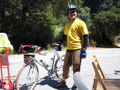
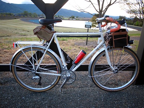
Sequoia on Cross Marin Trail
I started the day early, and got myself to San Francisco by 6:20AM via BART. I rode along the northeastern edges of the city to the bridge then crossed over on the eastern sidewalk. The entire city and most of southern Marin county was still shrouded in fog at this point. I rolled up Camino Alto and down through the hamlets--roads I have ridden so many times on San Francisco Randonneurs' brevets or otherwise. Whites Hill got my heart pumping and the subsequent flats on Sir Francis Drake kept the heart rate up. Soon I crossed a pedestrian bridge shortly after the town of Lagunita to get on the Cross Marin Trail.

Summit before dropping down to Olema
Top of the hill before Olema
A gem of a trail it is, and a great joy to ride on. The first portion is mostly dirt, but pretty packed down at this time of the year, and the speed remained high. The latter part of the trail has some newly laid down gravel that required a little more attentiveness but nothing too bad. Through the redwood groves I rolled, and in no time I was at the foot of the climb before Olema. The sky was clear by now but it was still breezy. Not many cars were on the road at this hour. I took my time getting to the top and enjoyed a fast descent. I purposely began braking a little later than usual to test the new brakes I have on the Sequoia--avid shorty 4. Initially, when I first installed them a couple of weeks ago, they weren't so hot in terms of stopping power, and they definitely squealed. I realized that the cable carriers were sitting too high for these low-to-mid profile brakes. I have since lowered the cable yoke, and on this occasion they stopped great and were silent.

At the Bear Valley Visitor Center
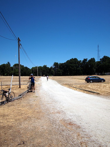
Bear Valley Visitor Center lot
I stopped at the Bear Valley visitor center to fill up my water bottle (and I only brought one today) and eat some food. I wasn't planning on going to the lighthouse nor Marshall in the north, like the SFR 200k route, but planned on going on Limantour Road on a bike for the first time. If there was an aim today besides getting out and ride, it was to check out 1 or 2 camp sites that one can bike to. One of these sites is Sky Camp, which is reachable via 1.2 miles of hiking/biking on Sky Trail, which starts on Limantour Road.

Beginning section of gravel on Sky Trail
Dirt on Sky Trail
The portion of Limantour Road I was riding is a steady, 3.75-mile hill that climbs 900+ feet. Although the gradient isn't steep, it's a relatively low climb. I found a good rhythm and kept a good pace to the top. Shortly after the road flattened, I came upon the trail head for Sky Trail. Though short, the Sky Trail was much more difficult than the much longer Limantour Road. The road surface was decent, but the trail has short steep pitches around tight corners, and even though the condition of the trail is decent, there is still uneven surfaces and loose gravel to negotiate. My rear Panaracer Col de la Vie tires, which has worn ridges, slipped a couple of times. I climbed to the summit of Sky Trail, and was a fraction of a mile away from reaching the actual campsite. But I was satisfied of my finding that the trail is ridable, and the scenery very nice--we will come back for an overnighter later!
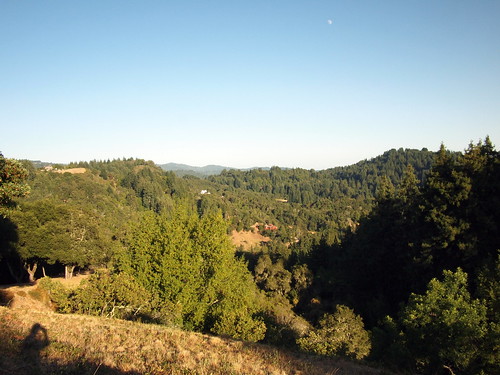
View from Sky Trail
View from Sky Trail
I was wary of the descent, mostly because I was afraid that the rear tire is too worn to provide good traction. It turned out to be OK as the brakes worked well again to keep my speed down without locking up my wheels. I got back to the trail head and was about to tackle my next off-road adventure--Inverness Ridge Trail to Mt Vision--when I realized I got a puncture on my rear tire.

Apparently a sharp piece of rock got through the worn area to the tube, and created a slow leak. I removed the culprit rock, patched up the tube, and remounted the wheel. One of the added advantage of 650b wide tires is that getting them up to 45 psi with a frame pump is relatively easy and painless (and I can't say the same about narrow tires that need to be filled up to 100 psi). I did manage to bend the nozzle a little bit. Although it showed no signs of leaking, I decided to forgo Mt Vision and instead ride down on Limantour Road to reach Pt Reyes Station quickly.
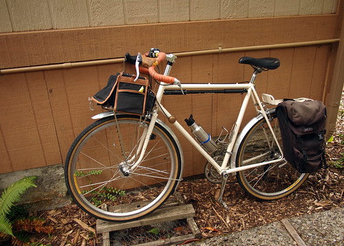
Black Mountain Cycles
Sequoia at BMC
I stopped by Mike Varley's Black Mountain Cycles to ask his opinion about the nozzle, and also to buy some energy food and a pair of brake pad inserts (salmon color) for the front brakes. Although these Avid Short 4 stopped great, they will stop better in wet conditions with salmon color pads. Mike said the nozzle should be OK. I pumped up the tire a little more with his floor pump now that my off-road adventures are over for the day, and the floor pump head seemed to have helped straighten the nozzle back some. After filling up my bottle and getting a piece of snack at the Bovine Bakery, I began the return leg of my ride

HWY 1
Rolling along HWY 1 near the Lagoon
I had various options for getting back to San Francisco. I could go through Nicasio and rejoin Sir Francis Drake, I could retrace my step and get on the Cross Marin Trail. I decided that I haven't ridden south bound on HWY 1 to Stinson Beach, and maybe I can catch that famous north-south tailwind for the stretch. The road down to Bolinas was a set of pleasant, but not remarkable rollers. But I was definitely wrong about the tailwind, as I felt no help, and at times had to fight a headwind. The temperature got cooler as I approached the lagoon, and fog was already forming on the horizon around noon.

Sequoia at the beach
Resting at Stinson
The stretch of HWY along the Bolinas Lagoon is one of the most pleasant. One is riding at water-level, and various type of migrant and non-migrant birds casually float on the water surface. The temperature seems to be always cool and the pavement is outstanding. You stay on the big ring and power through the slight roller fairly effortlessly. Soon the crowd at Stinson Beach began to emerge. I sat on the beach people-watched for a while after filling up my bottle again and ate some bars. Now I am feeling a craving for real food, but I didn't want to fight with the swarm of tourists and beach-goers in the town's small number of establishments. I rested my legs and rolled again.

Stinson from quarter way up Panoramic HWY
View from Panoramic Hwy
Now I have to tackle a major climb--up Panoramic Hwy to Pantoll Ranger Station. The scenic road gains 1400 ft in 4 miles, and steep in pitches on the lower sections. I tucked in on the drops, and spun up on a pretty low gear (34/28T I think most of the way), and enjoyed the scenery as I climbed up. The upper portion was much more covered and the gradient eased. It was a struggle after 60 some miles in my legs and no real food in my stomach at lunch time. The beautiful scenery and the cool breeze offered solace. I got to the ranger station huffing and puffing, but know that there is no tough climb left.

I stopped at Whole Foods in Mill Valley after dropping down from Mt Tam. I got some dolma, beet salad, and hummus at the salad bar, and a coconut water. The meal was very satisfying and gave me a second wind on my ride back to the City. After climbing up Alexander to the bridge, i had to contend with tourists on the eastern sidewalk again as the western sidewalk is only open on weekends. I was careful and rode defensively, but still got knocked over near the end by an unsuspecting tourist. The damage was a piece of lost skin on my hand and some small bruises as my right arm and hand made contact with the guard rail. After yelling at him to pay more attention, I rolled on, intending to catch BART before it becomes off-limit for bikes.

I got to BART station at 3:40, some 9 hours after I started this morning, and got back to Berkeley just after 4PM. The tally of the day--94 miles, 6500 ft of climbing, much pleasant to breath-taking scenery, and an opportunity to stretch my legs and clear my head. Jan Heine of Bicycle Quarter wrote an excellent piece on sensible performance bicycles for non-racers that I resonated a lot. Today's journey was a good example of what he is talking about. On a steel bike with wide-tires and fenders, racks, dynamo lighting, and a decent-sized bag, I was able to travel on both paved and unpaved surfaces, and traveled a lot of distance and rode some difficult terrain in not quite a day. The bike--an 80's Specialized Sequoia--has a frameset with standard-size tubes (not over-sized) that's lighter and more responsive, and allows the bike to stay under a reasonable weight even with all the "added" features mentioned above. I am by far not a fast cyclist, as I always finish in the bottom quartile of SFR brevets, but with a bike that's somewhat aimed at performance and a basic level of fitness, I get to go far today without rushing and enjoy the spectacular amazing coastal California scenery.
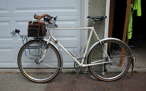
Tuesday, July 31, 2012

Santa Cruz Mountains Challenge: A ride report


Quarter way in...
Quarter way in the right, about to enter Big Basin State Park
At Saturday’s first water stop at mile 10 after climbing up Mountain Charlie on the Santa Cruz Mountains Challenge (we were riding the century version) , both M. and I were having such a hard time that we didn’t know if we could get to lunch, much less finishing the ride. I was at the tail-end of a 2-week bout with a cold that gave me incessant coughs and smothered my lungs with slimy fluids. Unfortunately I gave that cold to M. a couple of days into it and she was suffering the consequences also. The entire climb up Mountain Charlie I can hear her more-hurried-than-usual breathing, and she was sagging back on the climb—unusual for us as she has always been the better climber between us. At the time I felt disappointed, but a little resigned also given what we have gone through in 2012, getting a cold less than 2 weeks before a difficult ride is simply a confirmation that this isn’t the year for us.


The year 2012 has been a tough one, unexpectedly. We signed up for a challenge at our local spinning studio to train for and complete a challenging cycling event in late 2011 and started the training really well. We followed the base phase fairly religiously, and worked up our mileage in December to about 70 miles. And at the end of the year we were able to ride over the top of Santa Cruz mountains with a touring load at our end-of-the year tour. We even participated in the 3-hour year-end spin class.

Soon after that, a string of circumstances hit us which left us dealing with the aftermath ever since. We flew to S. Carolina to attend to M’s mom in January, and she passed away soon after that in February. M. had a series of health issues (probably stemmed from the trauma of loss) that prevented her from doing any exercise for about 6 weeks. While I continued to train and was still on target to ride our initial planned event for the Challenge the Davis Double, it became apparent that M. wasn’t going to be ready. We decided to switch our target to the Santa Cruz Mountains Challenge (SCMC), which was later in the year. While SCMC only had half the length as the Davis Double, it has almost twice as much climbing (> 11000 ft of elevation gain).

Heading into Big Basin State Park
Corner of HWY 9 and Big Basin HWY
I was able to attend spin classes in May and June and we rode outside with increasing distance almost every week in those two months. All the while wearing our HRMs and keeping a tap on our efforts. I was on track at the end of June, after riding brevet style (unsupported) from Ukiah to San Francisco in approximately 10 hours—the best time I have ever done for a 200k ride. July turned out to be super busy for us with a combination of work and school. We rode in Mt Tam 3 weekends in July with increasing amount of hill climbs to prepare for the SCMC, and began felt confident that we would be able to complete the event. Then on 12 days before the event, I felt a scratch in my throat, and despite my best effort to fight it off, the cold floored me, then M. for the next week and half.

Back to the water stop at mile 10 before the turn onto Bear Creek Road. We told each other that we will try to do our best, and just enjoy the ride. We rode on with a sense of resignation, but also felt more relaxed. We got to the first full rest stop at mile 20 at Skyline. After chowing down rest-stop food, and looked at the map, we realized that we had climbed 3500 feet in the first 20 miles, and therefore had completed 1/3 of the climbing already! With this realization came the encouragement that we might be able to get close to finishing the ride after all.

Let me go back to Mountain Charlie Road, which was the first climb of the day. It started at mile 2, and went up almost 1500 ft (including two side streets near the top) in 4 miles to Summit Road on a narrow, winding, and absolutely beautiful road. We are accustomed to much more warming up than the rolling first 2 miles leading up to the foot. Lots of very fit cyclists passed us on the way up and made the climb seemed easy, but it was definitely a beast. It was on this climb that we were shaken and felt strong doubts about our ability to finish.

Ebisu at Park Headquarter
Ebisu at the Headquarter of Big Basin State Park
The second major climb of the day is Jamison Creek Road in Big Basin State Park 20 miles after the first full rest stop. The transitional section is a gorgeous stretch of rolling, quiet, covered, and beautiful roads in and near Big Basin State Park. Jamison Creek is relatively a short climb in comparison with the long cols of the Death Ride, but rises up sharply. The route sheet says that Jamison Creek climbs 1500 ft from HWY 236 to Empire Grade in 3 miles. Not all three miles of this road are equal, either. The road starts out relatively gently to pull you in, making you think that you are having a good day on a famously steep road, then all of a sudden a “gotcha” hits you in the face approximately half way in, as gradients hit up to 14% or 15% all the way to the end. 

M's Ebisu after Jamison Creek Climb
M's Ebisu taking a break after Jamison Creek
Me at the top of Jamison Creek
M. and I separated near the bottom to each do our own climb. I got down to my lowest gear—34/30T pretty quickly, and tucked in, in a seated position. I tried to find a good rhythm and not getting off the saddle too much, in an effort to conserve some energy. Many riders passed me, pounding on their pedals off the saddle, but several of them had to stop and take a break as I steadied past them later. In the end, I didn’t have any energy left in my tank to get off the saddle and power up near the top, but did manage to spin my way there without stopping—my original objective. SCMC organizers timed every participant, and I clocked in at 39 minutes and change--definitely in the bottom quartile and a far cry from the fastest time of 20 minutes. M. came up a minute or so later. We were both gassed, and even though lunch was only short 1.5 miles away, we sat on the chairs provided by the water stop folks at the top for a good 5 minutes before rolling again. Without the cold and more training on steep hills, hopefully I can ride approaching the low 30 minutes next time. 

The only dirt section of the day--outside the lunch stop
The intervening miles between the top of Jamison Creek and the final hard climb of the day Zayante Road have some amazing stretches of descents (Pine Flat Road, Ice Cream Grade, Felton Empire Road). I wish I stopped more to take more pictures. M. overshot a turn and ended up a ways down on Bonny Doon, and I went down hill after her after not seeing her catching up and realized what was happening. We ended up climbing the famous (via Tour of California exposure) Bonny Doon road back to the course. The final big climb of the day is Upper Zayante, which is at mile 70 or so, 24 miles after lunch. Zayante is a very nice climb, shaded and quiet, with glimpse of the valley below. It was also deceptively long and hard. We chatted with each other and spun our way up. After that, it was a set of rollers and a long descent back to the finish.

Because of the detour, we ended up being one of the last people finishing, even though we both felt pretty good at the end. It is by far the most difficult ride we did in 3 years since the Shasta Super Century we struggled through in 2009. 

A nice view near sunset; near completion of the ride
SCMC is a great route, and the metric double version is a way to get close to Death Ride territory in terms of distance and elevation gain without the long travel, the heat, the crowd, and the altitude. We highly recommend it! For those brevet-minded folks, the Santa Cruz Randonneurs used to run a Big Basin 200k, which is advertised to be the hilliest 200k in the U.S. (though several mixed-terrain 200k organized by the San Francisco Randonneurs, my home club, might top the climbing statistics of Big Basin 200k). The Big Basin 200k starts in Palo Alto and winds through much of the first half of SCMC before ending up in Davenport on the coast, then traces the route back to Palo Alto. 

I was about the only person riding a randonneuring machine, and many roadies, friendly or not, made sure I know about it. There was another guy on a Klein that had metal fenders on. I was chatting with an older gentleman riding on a carbon fiber Time about our respective machines. I think my set up might be close to a full 10 lbs lighter than his (mine weighs in at about 27 lbs with rack, fenders, and a bag). I told him that I lost almost 20 lbs in the last year, which more than cover than 10 lbs differential between his and my bike. Both of our Ebisu performed really well for us--smooth and comfortable, responsive during spirited pedaling, and no creaking sounds throughout the ride! My 42mm tires allow me to keep my lines on several long descents where the pavement is rough. On a well-supported ride in the Bay Area summer I should be able to ride an open-wheel lightweight racing machine, but the Ebisu isn't really what's holding me back--that would be my own legs. 

Sunday, July 22, 2012

Specialized Sequoia Modification Part 2

After staring at the initial configuration of the Sequoia after it came back from some frameset modifications, I decided that the large-size Nitto front rack is a bit too large and mounts too much forward for my liking. This beautifully made and strong rack resembles the Highrider Rack that Rivendell sold for a while, but has additional accommodations for attaching detachable lowrider attachments. Rivendell describes this rack on its website as a rack that carries the load in the front a little higher than contemporary front pannier rack. For randonnering purposes and the low trail fork on the Sequoia, the rack isn't that high, but it certainly sit very much forward. Further, the light mounted on the front of rack looks almost ridiculous in how forward it sit. I thought about mounting the light lower and closer to the bike, but the front of the rack seems to be the only reasonable place to attach the front light, as light mounted anywhere on either side of the rack would likely obstruct panniers hanging either on the top rails, or on the lowrider attachments when they are installed.

At the end, I think the combination of a Mark's Rack and a Tubus Tara lowrider rack is better looking and ligher than the aesthetics that the Nitto big rack brings with it. And both configurations allow me to carry a front bag and two panniers. The only advantage the Nitto front rack has is that I can carry heavier and bulkier objects such as a tent, a sleeping bag, or a sleeping pad on the top while hanging the panniers on the side. But I will think of something to address that issue later.

I also took a couple of pictures of the fender bit that allows me to not use a L-bracket clamp on the rear fender. These pictures show the progression that the Sequoia went through since I bought the frameset last year:


Summer 2011; Stock fork; Blackburn rear rack; VO front rack; Rivendell Banana bag
Summer 2011; VO front bag; Shimano Dynamo Wheel and B&M IQ CYO light added
Early Spring 2012; Kogswell Konversion Fork
Late Spring 2012; on tour; Axiom pannier on rear rack; Rivendell Banana bag removed
Summer 2012; Cantilever posts added; Selle San Marco Ischia Saddle; Mudflap and rear light attached to fender; Nitto Highrider front rack; Avid Shorty 4 brakes
Summer 2012; Nitto Mark's Rack and Tubus Tara Rack


Tuesday, July 17, 2012

Specialized Sequoia Modifications Part 1

In my last blog post I wrote about some planned changes to my Specialized Sequoia, the most serious of them being adding cantilever posts to the frameset. I dropped the semi-disassembled frameset at Mike Cleaver's new shop in Berkeley last week, and went about planning and getting other parts for other application, like selling some bike parts to fund the metal work, etc. I got the frameset back from Cleaver last night and built it up in the early hours of this morning before work.

Cleaver did a great job welding Paragon cantilever posts to the fork and the seat-stays. He welded them on, then covered the welds by brazing copper fillets on them. The work looks clean, straight, and well-aligned. Cleaver's new workshop is in a community space with 27 other artisans--definitely worth a visit. He is pretty responsive and gave me back the frameset within the agreed upon period. His new tandem looks rad, also.

I rattle-canned the bare-metal spots with satin-finish clearcoat--a strategy I employed on M.'s old Trek when it got modified and worked well. With the wheels and fenders still off I cleaned up the bike with a damp cloth first. I got this neat little bit from Somervillebikes of Flickr. The bit is fasten to the rear brake bridge with a threaded brake bolt, and it has a downward facing threaded tap for the fender to attach from the bottom. I installed the rear fender, then put the rear wheel back on. I then installed the new-to-me Avid Shorty 4 cantilever brakes. Some people don't like these brakes for difficulty in setting up and lack of stopping power. I used them on my old Raleigh One-Way and they worked pretty well for me--easy to set up, stopped well, and no squeal. I got a bike's worth of them for under $20 so it's worth a try again.

Now I have to decide what rack I want to use with this set up. I have acquired a Nitto big front rack (that comes with detachable low-rider attachments) over the weekend and it's between using this rack or a combination of a Mark's Rack and a Tubus Tara. Nitto got the nod at this moment. I have to play around with which holes to use for attaching to eyelets at the dropouts, and have to use mucho spacers to attach the rack to the front fender without ruining the fender line. Then I have to find a place to mount the B&M IQ Cyo lamp. At the end every piece fit together. Though I have yet to road-test the new set up. It at least looks nice!

The final touch is the addition of mudflap and rear light mount on the rear fender. I always dreaded putting mudflap on but it's courteous to ride with a mudflap when you are riding with people in wet weather. It was actually pretty simple to create mudflap out of rubber/plastic sheets from the hardware store then mount it together with the rear light mount. I think the result looks pretty good. We won't know how it works until a few months from now, when it begin to rain again in this part of the world.