 We woke up around 8AM in the morning in Santa Cruz after riding here from San Jose and spending a great day watching the ocean and chilling. Today we are riding back to San Jose, but not the way we came. Soquel-San Jose Road can be an exhilarating descent, but riding up on it may not be as fun. Today our plan was to ride west first through towns of Capitola, Aptos, and Corralitos, then up Eureka Canyon Road to the ridge and continue on Highland Way back to rejoin Summit Road. This will add about 17 miles to our trip and make it a 52-mile ride. With our haul, this is not easy, but the gradient on all the climbs today should be pretty gentle.
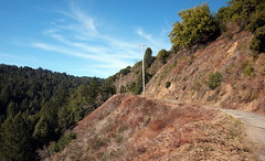
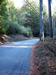
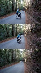 Eureka Canyon Road is a winding, shaded, fairly well-paved and mostly narrow road. At times there is only one lane. The grade is very gentle. We were able to chat almost all the way up and I was riding mostly on my big chain ring. The road is lined with different kinds of beautiful tall trees and we were constantly greeted by birds and squirrels. For most of the time our view didn't go much beyond the canyon and the creek running beside the road. As we climbed higher views of the canyon below and the surrounding hills emerged. Toward the top near the junction with Highland Way the pavement is not as good (but still very good) and the road is more exposed. On this cold but clear day, sun was a much welcomed sight to warm us up a bit.
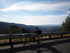
 We got to Highland and rode on the ridge for a good half a dozen miles. There was no significant climbs, but some gentle rollers. The road has a mixture of forest and wide vista of the canyons, mountains, and even a glimpse of the ocean below. Highland eventually turned into Summit Road. After taking a break at the Highland Market, we got to Old Santa Cruz Hwy and began the descent down to San Jose. The trip downhill is pretty fast, and we rode fast on back on the Los Gatos Creek Trail. About a mile away from the train station I hit a tack on the pavement and had to fix the flat. Good thing it was so close to the destination so i didn't have to ride with low pressure for long. We were both very tired from the trip and napped on the Amtrak ride home. It was a fun Christmas trip!
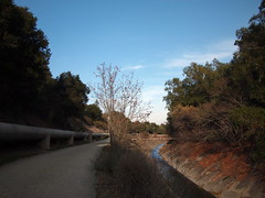
Here again, is the slideshow for the whole trip:
No comments:
Post a Comment