This blog is about my cycling lifestyle, which includes (obviously) bicycles--both building and maintaining them, and riding them--and cycling related tidbits.
I work at a small liberal arts college in Ukiah, California, the seat of Mendocino County about 110 miles north of San Francisco. I live in Berkeley so I carpool with colleagues up to Ukiah every week and stay overnights. Even though as an administrator I work through the summer, I did have an opportunity to take a day off this week and ride my bike down from Ukiah to San Francisco. The back roads of Marin, Sonoma, and Mendocino counties are wonderful--they collectively present riders a diversity of terrains, scenery, vegetation, and towns and cities. Many of the areas two randonneur clubs--the San Francisco Randonneurs and the Santa Rosa Cycling Club--both organize brevet routes of different lengths on these roads. In fact, the two clubs are collaborating in July on a two-day, two-events weekend that see routes go in both directions between San Francisco and Cloverdale, which is at the northern edges of Sonoma County. I have ridden from the Bay Area to Mendocino county on several different routes, at least once-yearly for a decade, but curiously had never ridden from north to south. I had thought a while about submitting a permanent route to RUSA so sometimes I can do this ride and get randonneur credits for it. After finishing a long meeting on Monday evening, I packed the stuff I planned on carrying and readied the bike. I aimed for an early morning start to get back to San Francisco in the afternoon.
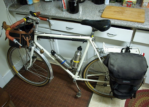
Sequoia getting ready for a long day's ride
My Specialized Sequoia is the steed for this occasion. It also serves as an opportunity for me to bring it down to the Bay Area for some frame modifications I have been thinking about. This bike has been working wonderfully, except for one area that can use some improvement. The front centerpull brake is simply too mushy and I don't feel like it has enough stopping power. I have scheduled with a local frame builder to add cantilever bosses on in a couple of weeks. That digression aside. I packed up my Mac Book Air and its adapters, a couple of magazines I was reading, and a cable lock into a single pannier that I hung on the non-drive side of the rear rack. I also packed energy bars, a flask of energy gel, my camera, wallet, cellphone, and sunscreen lotion into the Velo Orange Campagne handlebar bag (which also has the bike tools in its front pocket). I was also carrying two Klean Kanteen 27-Oz water bottles and a Zefal frame pump. The load was somewhere north of 10 lbs, perhaps 15 depending on the amount of food and water I had at any given time.
Early morning shadow on Old River Road
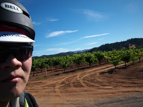
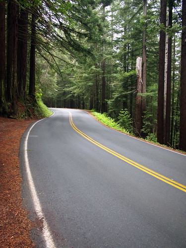
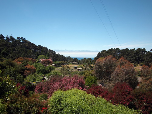
At 6AM, after eating some oatmeal for breakfast, I rolled off the campus and onto Old River Road, a mostly flat and gently rolling 14-mile stretch that takes one from Ukiah to Hopland, the next town south. No one was on the road and I warmed up with a heart rate in the 130s. The miles went by quickly and soon I was in Hopland and the morning chill was not a factor anymore. One can take one of two routes between Hopland and Cloverdale--the shoulder of HWY 101, which is flatter and shorter, or on Mountain House Road then HWY 128. Even though the shoulder of HWY 101 is wide and at this early morning hour car traffic is sparse, the quieter, hillier side road beckoned. I was looking forward to the effort to keep myself warm as we were having an unusually cool stretch in June in Northern California. Mountain House Road is really two climbs, with the second one more substantial and ends on HWY 128. It's a quiet and at times narrow road that provides its travelers with a nice view of the canyon and valley below. It also has pretty decent pavement. Besides stopping a couple of times to adjust the pannier attachment and snapping a few photos, I pedaled on and soon I was at HWY 128/Oat Valley Road.
Golden Pasture on Mt House Road
HWY 128 is the main corridor from inland wine country to Boonville and Mendocino Coast. The east bound direction at this time is pretty quiet. After a set of gentle rollers the road descended for a decent stretch down into Cloverdale. At this early hour the town was barely awaken. Dutcher Creek Road awaited south of Cloverdale.
Dutcher Creek Road is a very nicely-paved road that has a hump half-way through, and with vineyards dotting its landscape. Dry Creek Road is my next turn, but I made a mistake and turned right instead of left at the intersection of Dutcher Creek and Dry Creek. After a mile or so of increasingly desolate landscape, I entered Lake Sonoma Recreational Areas, which was unexpected from my planning. I realized that I made a mistake and turned around.
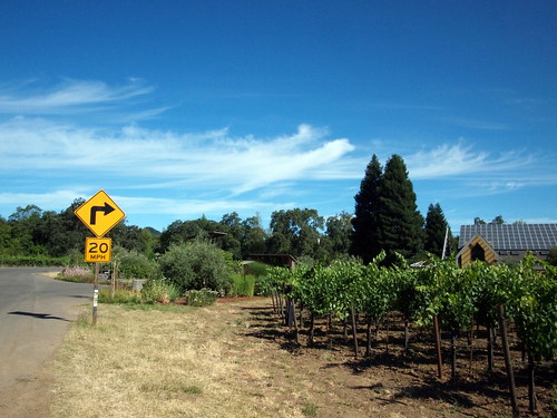
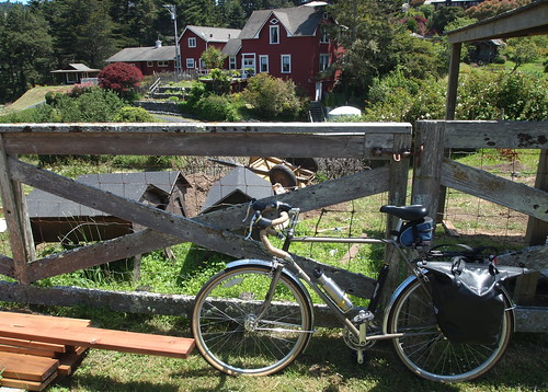
Solar-Powered Farm House and Vineyards on W Dry Creek Road
After getting back on track, I crossed Yoakim Bridge to get on West Dry Creek Road, and began perhaps the most scenic stretch of my ride today. West Dry Creek Road is narrower and a little more twisty than its easterly counterpart, but it takes you past beautiful vineyards, orchards, gardens, and farm houses one after another, with the valleys and mountains in the background. I actually rode faster than I would have enjoyed because I was trying to stay ahead of a garbage truck doing its route, but I still thoroughly enjoyed the road. West Dry Creek Road stopped on Westside Road, which takes one into Healdsburg.
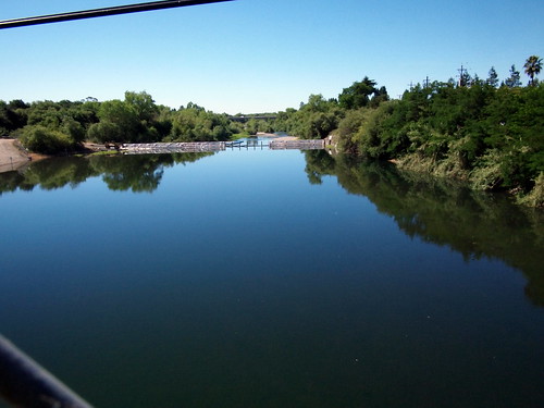
Russian River near Healdsburg
I stopped at a bike shop to buy some more energy food and fill up my bottles. Even though I was making good time--at this point I had ridden 56 miles and it was 10AM I decided to forgo the more scenic but longer route to the west that takes one through Graton and Sebastopol and follow Old Redwood HWY east of HWY 101. Old Redwood Hwy is a long, fairly straight, and flat road that used to be the old HWY 101. The roads are wide and bike lanes line many parts of the road. I fueled up and got on the not-so-aero drops of the midge bar on my bike, and rode tempo (with heart rate in the 140s) all the way into Santa Rosa. At this point it was 10 past 11AM, and I decided to not stop and head toward Petaluma. Petaluma Hill Road heads southeast out of Santa Rosa before straighten into a direct south road through Penngrove and merges back onto Old Redwood Hwy. The road is basically flat, with a tiny (almost undetectable) gradient before flattening out again on McDowell Road in Petaluma. I stopped in a shopping center at the intersection of East Washington Street to buy a sandwich, several energy bars, and a bottle of Zico coconut water. I found a picnic table and took my lunch break. I was at mile 90 at this point, and counted a series of 7 smallish hills still ahead.
Wildflowers near Cheese Factory
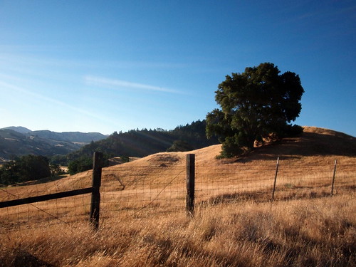
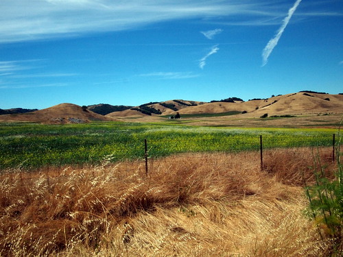
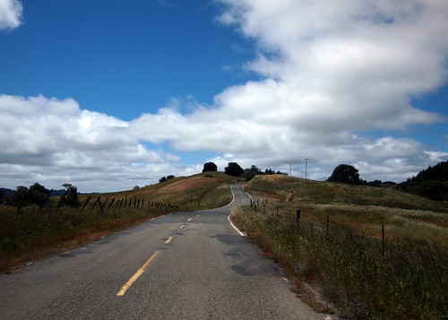
Given the cool weather, I was able to keep my wool sweater on the entire morning. But the noon sun was at full force at this point, and I took the sweater off before climbing on D Street out of Petaluma. D Street has a very gentle grade through a nice part of town with many shaded spots. The street dips a little before resuming climbing, at some point turns into Petaluma-Point Reyes Road. The second climb is slightly more demanding but not difficult. At the top one gets a good view of the valley ahead and the golden pasture that is common in California at this time of the year. The fast descent took me to the cheese factory, where I emptied the bladder and lied down on a bench for a few moments of respite. I filled up bottle again and finished the rest of the coconut water that I carried from Petaluma. The climb from Cheese Factory westward is very easy, but the descent on the other side is extended and fast. Soon I turned left on Nicasio Road and began the home stretch.
Sequoia in Sausalito with the City in the Background
The section of roads that takes one from Nicasio through the Marin hamlets and back to San Francisco is familiar to local cyclists, especially randonneurs as they are on the routes of most brevets that begin and end in San Francisco. I know the roads and the climbs well, and was able to meter my effort to stay comfortable yet make good progress. Nicasio Valley, Whites Hills, Camino Alto and the towns along the way hustled and bustled as the evening commuting hours drew near. I got to Sausalito at 5PM and after taking a break, crossed the bridge and got back into the City by 5:15PM. It was a beautiful day in San Francisco. At 5:30PM I got to BART station and had to wait on the platform until it was OK for bikes to go on the evening commuting trains. It was a beautiful and great route to ride 136 miles!
My bike performed very well, even with the rear load, I never felt like I was fighting my bike. On both climbs and descents it was easy to handle. The tubing was not overly flexy under the load I was carrying, yet give just enough to produce the planing effect, especially when I am on my big 50T chainring, which was most of the day. Now I get to take it apart some and get more powerful brakes, which shall be appreciated when I need to carry a real touring load in the future.
After spending a wonderful day in Mendocino yesterday, we weren't quite ready to drag ourselves over those same three hills we climbed over two days ago. However, the holiday weekend will soon end and we want to get back with some time to regroup. The day started with some rain, so we took our time eating a big breakfast--we ate 2 tofu burgers, 3 avocados, and two heaping bowls of granola between the two of us--and waited for the rain to subside.
And it did fairly quickly. We packed up, said goodbye to our host, and were on our way. The first stretch on Little River Airport is pretty flat, the gentle and windy climb starts at about 1.5 miles in, and 1.5 miles later we are on the ridge again on Comptche Ukiah Road. Now we are on a roller that's trending downhill. The road is covered, and the pavement is pretty smooth. This was very fun stretch and our speed was high. We got down to Comptche--a 12-mile stretch in just 30 minutes (here are a couple of videos of cruising on this ridge: #1 and #2).
M. has recovered enough and was feeling hungry. We sat at the Comptche Store and at energy bars. I also took her lock from her bag so her load will be lighter going up the next two bigger climbs. Going up to the top of Comptche Ukiah Road from Comptche is a very nice climb. The grade can be high at some point, but we are under the trees for the most part, the pavement is good, and the gentle curves of the road is inviting. We both got on our low gears on our middle chainring (in my case, the small chainring of 34T since I was using a compact double) and a largish cog and spun our way to the top. We ate again at the top, and put on a layer of windbreakers. The roller was quickly replaced by a fast descent to the flat on Orr Springs Road again. Now we are riding a very gentle, almost not detectable grade back through Montgomery Woods and Orr Hot Springs before we have to climb up the big hill.
The weather is still overcast in the valley, but it wasn't so foggy and wet like earlier near the coast. We were worrying earlier that our water supply might not enough to get us all the way back, as on the way over we were pinching during the last 2-3 miles. However, the coolness of weather kept us from drinking too much and we each had a full bottle before climbing up the last climb of the day.
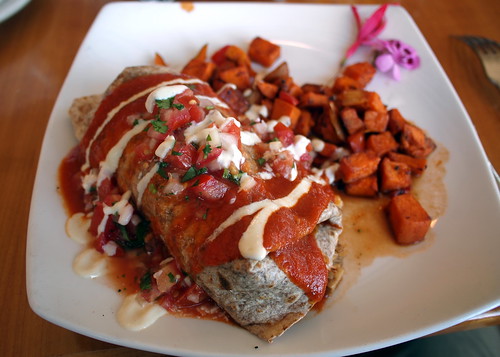
We slept soundly after carrying ourselves and our bikes over 3 hills yesterday. We woke up in the morning and planned our day--which has no real plans except getting ourselves to the town/village of Mendocino and enjoy the day. We did have a reservation at Raven's Restaurant at Stanford Inn. The restaurant boasts a great menu of vegan brunch items. We have ridden/driven by it many times but this will be the first time we eat there.
We packed our bags for the day--books, layers, snacks, and water bottles--and headed out. The ride from Little River to Mendocino started with a fast descent on Little River Airport Road toward Highway 1. The scenic highway then takes us to the intersection of Ukiah Comptche Road where the restaurant is and a stone throw from the Village of Mendocino. Stanford Inn has a large farm/ranch where they grow much of their ingredients. The entrance of the restaurant/inn lobby is at the end of a short but steep grade, nestled behind a beautiful garden.
The dining room has many windows and a gorgeous view. We enjoyed our brunch very much, and as well as the ambiance of the restaurant. We'd definitely recommend it as a place to eat and stay. We stopped by the ranch to check out the vegetable gardens and some curious farm animals, before getting on our bikes and headed to town.
On Friday night of the first weekend of Summer, we drove up to Ukiah where I work 2-3 days a week with M's Trek 720. I already have my Specialized Sequoia there. We went to bed ready for a morning start to Mendocino. In the morning, we got ready and packed lightly. We had the option of camping on the coast this time, but we were wary of the monster climb on the way over and back on Orr Springs Road. We found a place on airbnb (follow the link if you are interested in joining; I get some referral credit) in Little River, which is 3 miles south of Mendocino so we don't have to bring our camping gears.
M. uses a single Ortlieb shopper pannier on the Tubus Logo rack. She carried her change of clothing (including some layers for the cool coaster weather), toiletry, a pair of lightweight street shoes, locks, sunscreen lotions, and some school book to read for a class she is taking. I also brought a change of clothing, lock, a book to read, energy bars for the two of us, bike tools, my iPod touch for Internet access, and my trusted Olympus EP-1 camera. I used Shimano touring shoes for riding with my crank brothers Candy pedals and walking around and didn't bring an extra pair of shoes.
We ended up setting off closer to lunch time, and ate brunch at Ellie's Mutt Hutt first. The big vegan breakfast that we ate ended up being great for the physically demanding ride. After brunch, we meandered through Ukiah to get to the north end of town. On North State Street, we turned west on Orr Springs Road and quickly began the first and the toughest climb of the day.
Starting from the base, Orr Springs Road climbs for 4 miles pretty relentlessly for an average of close to 10%. Some pitches are steeper than that. Climbing it on a lightweight road bike without carrying anything can a challenge and today we were on our touring gigs with approximately 15-18 lbs of load each. We both had our heart rate monitor on to make sure we don't blow our tops off on the first climb. I dropped down to 34T/28T combo (and M was on 36T/28T) and tried to spin as smoothly as possible going up. I think my speed was hovering between 4 and 5 mph. One great thing about Orr Springs Road is that it's very pretty, and not too much car traffic.